emergency.wa.gov.au

Storms on the way despite record hot and dry spell
Thursday 23 May 2024
Prepare now for storm season before it’s too late. That’s the message from the Department of Fire and Emergency Services with the record hot and dry weather expected to end soon as winter fast approaches.
The Bureau of Meteorology is forecasting a typical winter for southern WA so residents are urged to take advantage of the current warm conditions to get their homes ready for potentially destructive storms.
DFES Deputy Commissioner Operations Craig Waters AFSM warned people not to be complacent because of record hot and dry weather from October to April.
“Don’t get caught off guard when the weather turns. The worst damage is often seen in early winter before property maintenance has been done,” he said.
“Now is the time to clear your gutters so excess water doesn’t get inside your home, remove overhanging branches and tie down loose objects so they don’t become projectiles in strong winds.
“After such a long, dry spell in recent months, keep an eye out for built-up leaf litter, loose branches and dead or damaged trees which could break off or fall over in strong winds.
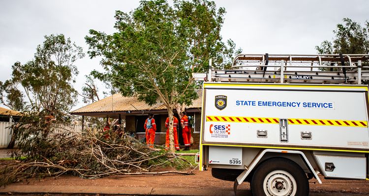
“Preparing your home now will not only relieve pressure on our State Emergency Service (SES) volunteers who often respond to urgent calls for assistance, it could save your life and protect your property.”
From May to August last year, the SES received almost 1000 storm-related calls for assistance, including roof and structural damage, fallen trees or branches and water damage.
Bureau of Meteorology Hazard Preparedness and Response WA Manager James Ashley said conditions through south-west WA in autumn had been significantly warmer and drier than normal but the weather pattern was starting to change as winter approached.
“The high pressure system that has been sitting to the south and south-east of the State for much of autumn is breaking down. It is expected to be replaced by a series of cold fronts over the next week that will bring westerly winds and rainfall to the south-west,” he said.
“While these cold fronts are unlikely to produce severe weather, they are a timely reminder for all of us to follow the advice of DFES and our local emergency services to ensure our properties are ready for winter storms.
“The long-range forecast suggests average to above average rainfall to much of the south-west of WA. Typically the south-west of WA sees four to six cold fronts across the cooler months, including one or two each month which bring severe weather.”
Advice on how to prepare your home for severe weather can be found on the DFES website at www.dfes.wa.gov.au/hazard-information/storm.
If your home is badly damaged by a storm and you need assistance to make it safe, you can call the SES on 132 500.
Stay up-to-date with severe weather warnings by checking www.emergency.wa.gov.au, calling 13 DFES, following DFES on social media and listening to local radio broadcasts.
Find the Bureau's forecasts and warnings at www.bom.gov.au or on the BOM Weather app.